geod-global
Health Warn
- License — License: GPL-3.0
- Description — Repository has a description
- Active repo — Last push 0 days ago
- Low visibility — Only 5 GitHub stars
Code Pass
- Code scan — Scanned 12 files during light audit, no dangerous patterns found
Permissions Pass
- Permissions — No dangerous permissions requested
No AI report is available for this listing yet.
Geospatial data aggregation for Windows: imagery, terrain, land cover, climate, ocean, population, vectors and map services. 17 categories and a BYOK Agent.

GeoD Global
Imagery, terrain, thematic data, vectors and map services in one workspace.




Download 0.2.1 · CDN · Website · Feedback
English · 简体中文
A Windows workspace to choose data by type, search an area, preview selections and download local results.
Explore manually or connect your own model to prepare searches and download tasks with the Agent.
Local use requires no Global account.
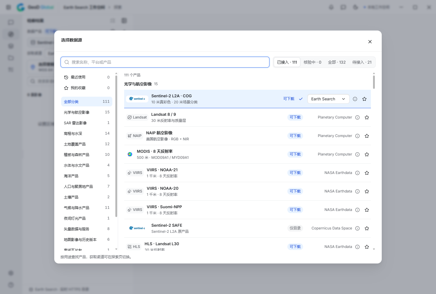
17 categories · 110 available entries · 2 authorization entries
Earth Search · Microsoft Planetary Computer · NASA Earthdata / GIBS · JAXA public products · INPE / Brazil Data Cube · OpenTopography · Geospatial Data Cloud
Watch the features
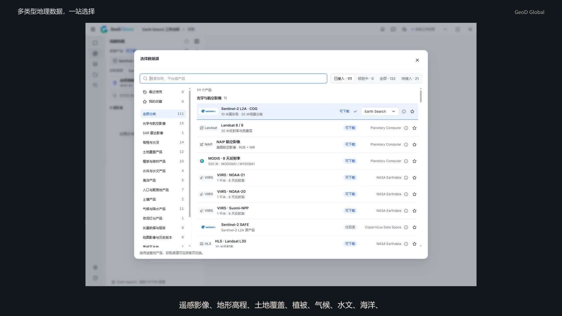
Watch the 62-second feature video · MP4 in this repository
Data types and channels, area search, multiple selection and map preview, downloads and local results. Recorded in the installed Windows 0.2.0 app, with Chinese narration and subtitles.
Find the data you need
| Data type | Connected products and channels |
|---|---|
| Optical and aerial imagery | Sentinel-2, Landsat, NAIP, MODIS, VIIRS, HLS; public CBERS and EnMAP products |
| SAR radar | Sentinel-1 RTC |
| Elevation and bathymetry | Copernicus DEM, SRTM, NASADEM, ALOS AW3D30, USGS 3DEP, ETOPO, SRTM15+ |
| Land cover | ESA WorldCover, Esri / Impact Observatory, GLAD, GLC_FCS, CLCD 2004, SinoLC-1 Shanghai |
| Vegetation and forests | MODIS NDVI / EVI, Hansen forest change, GEDI canopy height, Global Mangrove Watch, JAXA forest products |
| Water and hydrology | JRC surface water, HydroSHEDS flow direction and accumulation, DE Africa annual water observations |
| Ocean | Sea-surface temperature, surface wind, chlorophyll and ocean heat content from JAXA and NOAA |
| Population and settlements | WorldPop, GHSL, World Settlement Footprint, HREA |
| Soil | JAXA soil moisture, SoilGrids WRB 2017 |
| Climate and precipitation | CHIRPS, CHELSA, NOAA NClimGrid; JAXA land-surface temperature, rainfall, radiation, evapotranspiration and aerosol products |
| Nighttime lights | OpenLandMap annual nighttime-light DN products |
| Vector data and services | geoBoundaries, OpenStreetMap / Overpass, WFS, OGC API Features, ArcGIS Feature Service; public Microsoft building and Geofabrik files |
| Map imagery services | NASA GIBS, WMS, WMTS, XYZ, TMS, ArcGIS MapServer / ImageServer |
| Offline maps | Protomaps / PMTiles public tile archives |
| Raster catalogs and coverages | STAC API, static STAC, single Items, COG / GeoTIFF URLs, WCS; download links exported from your own Earth Engine project |
| Local files | GeoTIFF / COG, GeoJSON, GeoPackage, Shapefile, OSM XML / PBF, PMTiles, MBTiles |
| Data portals | Geospatial Data Cloud: connect your account to search and download supported products |
The directory contains 133 entries, including products, protocols and local formats, with 21 planned entries.
Products have version, region and file boundaries. See the full data catalog for individual scope and access conditions.
One path from source to result
| Choose | Explore | Confirm | Download | Inspect |
|---|---|---|---|---|
| Classified products and access conditions | Compact lists, multiple selection, map preview | Source, area, files and destination | Persistent jobs and explicit outcomes | Local files, provenance, checksums and source pixels |
- Latest 100 results first: load more on demand. NAIP prefers the latest acquisition year; changing areas does not enumerate all historical data.
- Bring your own model: scoped native tools, task review and persistent jobs. Home conversations and Explore sidebar tasks retain separate selection contexts.
- Source-aware results: multiple-layer preview, raw-pixel inspection and supported compatible-grid crop/mosaic. Rendered exports and scientific originals stay distinct.
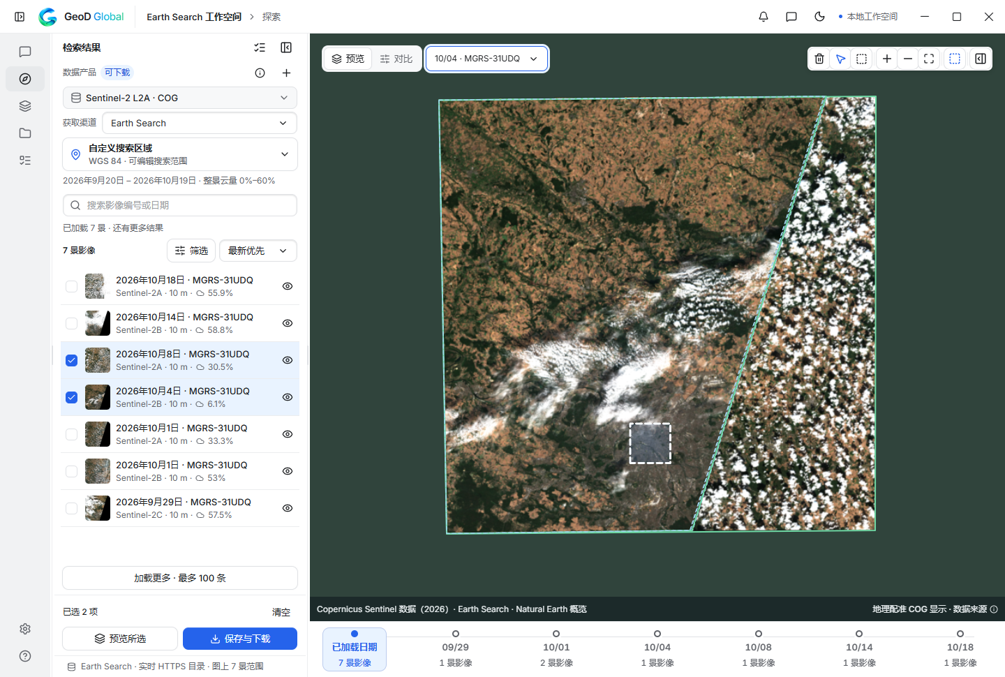
Installed 0.2.0, October 19, 2026. Copernicus Sentinel imagery via Earth Search. Image provenance · Release acceptance.
Get started
- Download the Windows x64 setup EXE or complete portable ZIP from the website CDN downloads; GitHub is also available.
- Microsoft Edge WebView2 Evergreen is required. No separate Node, Rust, Python or system GDAL is needed.
- Choose a source and area in Explore, search, select results and review the download. Connect your own model in Settings for Agent mode.
Files are unsigned. Check SHA256SUMS.txt and the release manifest; checksums are not a Windows publisher signature.
Quit via the tray before manual upgrades. Uninstall preserves user data. Windows instructions
Access, privacy and scope
Data-provider accounts and licenses remain separate. Protected sources need your own access.
Earth Engine uses your project and may consume its quota. Planned entries are not finished integrations.
Anonymous usage statistics are on by default, with off controls in Settings and saved opt-outs preserved.
They exclude conversations, keys, account details, precise locations, scene IDs and file paths. Data boundary.
Model requests contact your configured provider; data requests contact the source.
This release focuses on 2D data, including elevation rasters. Hosted AI, live paid services, cloud sync,
general cross-grid processing and non-Windows installers are not included.
Source scope · Provider status · 0.2.1 notes
Develop and contribute
Windows x64 development requires Node 22.13+, npm 10+, Rust 1.91.1+, Visual Studio C++ Build Tools and WebView2.
Run npm ci, npm run agent:prepare, then npm run desktop:dev from the repository root.
Development guide · Agent architecture · CLI / MCP ·
Processing example · Packaging
Suggest datasets and report reproducible problems through Issues.
Include product, period, steps and version; exclude credentials and private client data.
License
First-party code: GPL-3.0-only, © 2026 Gao Pengbin. Commercial use is permitted under GPL obligations.
Separate commercial permissions may be discussed. Datasets and components retain their own terms.
Reviews (0)
Sign in to leave a review.
Leave a reviewNo results found